This is keel country first. Narrowboats are visitors. A Bolinder 1051 on this quiet agricultural navigation would be a rare treat — we have not yet found a public film of Andora working it. For hot-bulb sound, stay on Sound & video.
| Kind | Canal plus River Hull, East Riding of Yorkshire |
|---|---|
| Opened | 25 May 1770 (Act May 1767) |
| Built for | Humber keels about 61 × 14.5 ft; draft limited loads to about 70 tons |
| Canal cut | About 5.75 miles Emmotland to Driffield; IWA quotes 14.5 miles including branches |
| Authority | Driffield Navigation Trust |
| Last keel to Driffield | Caroline, 50 tons of wheat, 16 March 1945 |
| Last commercial | Ousefleet coal to Frodingham Wharf, December 1951 |
| The stopper | Wansford (Skerne Road) Bridge — swing span replaced by a fixed bridge in 1967 |
River Head
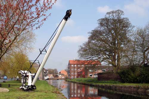
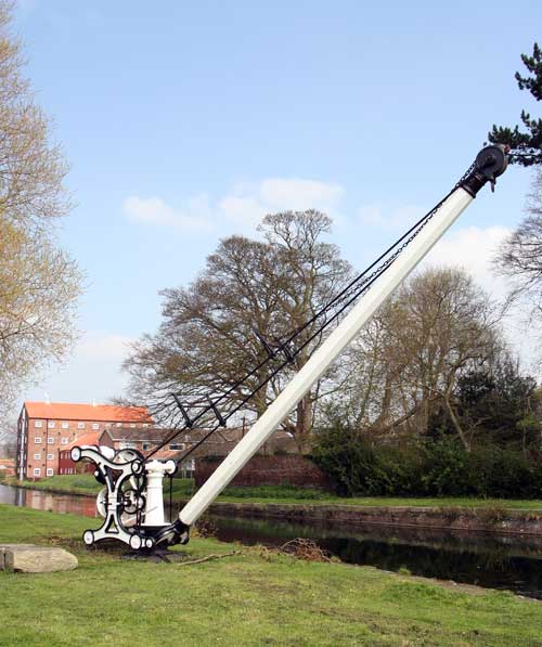
At Driffield River Head the archive photographs show open water, wharf character, and at least one historic crane — cargo-era furniture, not merely scenery. Close-ups of the crane machinery sit next to wider views that place the head in its town-edge landscape.
Lock ladder
The original canal section used four timber-floored locks sized for those keels. Sheepwash became Town Lock. In 1776 the commissioners converted Snakeholme into a two-lock staircase instead of building another lock at Thornham Bottoms. Later works on the “New Navigation” added Struncheon Hill above the tidal Hull.
| Place | Notes |
|---|---|
| River Head basin | Terminus; crane and warehouse character |
| Town Lock (Sheepwash) | Restored 1996 |
| Whinhill Lock | Restored 2005; a fixed bridge over the chamber still limits length |
| Wansford Lock | Recommissioned 2009; first boat in about 60 years |
| Wansford Bridge | Fixed 1967 — the full-length stopper |
| Snakeholme Locks | Staircase from 1776; reopened 2003 (upper chamber in use) |
| Brigham / Frodingham | Swing bridge restored 2003 |
| Struncheon Hill | Later lock onto the tidal Hull |
Further reading (lock pages): Wansford Lock, Whinhill Lock, Snakeholme Lock.
First locks and gate restoration
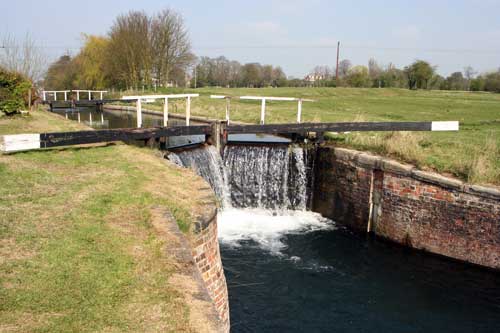
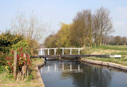
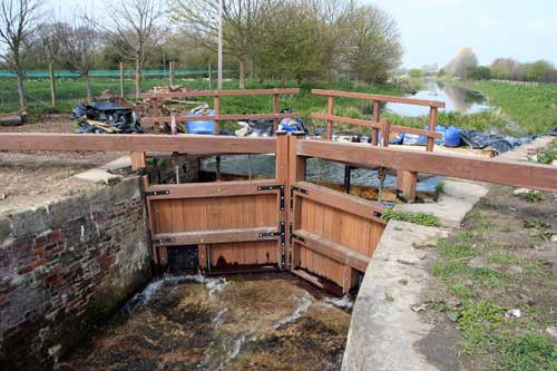
Downstream of the head, the first lock chamber appears in both tight and full views. Separate frames document replaced lock gates between Driffield River Head and Wansford — new timber and ironwork against older masonry. Navigations survive because people keep rebuilding them.
The 1967 bridge
After commercial traffic ended, the old commissioners dwindled until they could not take legal decisions. In 1967 the county council replaced the swing bridge at Wansford with a fixed road bridge. The Trust still names it as the only bridge that stops the canal being fully navigable. From the Hull, boats can work up to that span. Above it, the isolated pounds are for small or portable craft unless something changes.
This page is not a pilot guide. The Humber and the tidal Hull are serious water. For notices and dimensions use Driffield Navigation Trust — locks and bridges.
Wansford and the Trout Inn
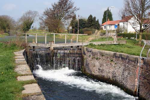
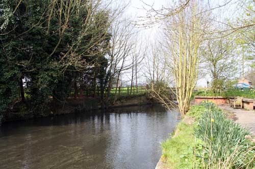
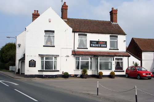
Wansford Lock was restored with a flood bywash and new gates, and commissioned in 2009 — the first boat in about sixty years. The Trout Inn is the social landmark the old archive called position “B” on its sketch map.
Restoration in short
DNAA formed in 1968. Town Lock 1996. Brigham swing bridge and Snakeholme 2003. Whinhill 2005 (still squeezed by a bridge over the chamber). Wansford Lock 2009. The Trust still wants an opening replacement at Wansford Bridge, and a lot of dredging.
Films (modern, not grainy archive)
A longer catalogue exists. Old tape, 1990s camcorder openings, 1960s floods, and a dinghy clip shot on a phone are left off this page. These four are clearer, recent enough to watch, and they show the place. They are not owned by this site. Credit the uploaders. No autoplay. They are location films, not Bolinder films.
Andora and Bolinder sound
We have not found a public YouTube film that is clearly Andora (Bob / Bobby Tidy’s Bolinder 1051 Josher) working this navigation. Tidy’s public channel shows Battersea with a National engine — a different boat. If you filmed Andora at River Head or Wansford, please contact us for credit and embedding.
For the thud itself: Sound & video (including Myk Askin starting Spey’s single Bolinder). Those films are not Driffield.
Reading the photographs today
The stills are mid-2000s field notes. Water, vegetation, and gates will have changed. What endures is the structure: head basin, lock ladder, a social stop at Wansford, and a road bridge that still argues with the original swing span.
FAQ
Can a full-length narrowboat reach River Head from the Hull?
Usually no. Locks have been restored, but Wansford Bridge has been a fixed span since 1967. The Trust still wants an opening replacement. Small or portable craft can use the pounds above. Check the Trust, not this page, before you go.
Is this a Bolinder engine page?
No. It is a place note. Keels came first. A Bolinder on this cut would be unusual and welcome. We have not claimed any film here is Andora.
Why a staircase at Snakeholme?
In 1776 the commissioners converted the original single lock into a two-lock staircase so boats could use it over a greater range of water, instead of building a new lock at Thornham Bottoms.
Facts drawn from Driffield Navigation Trust, Inland Waterways Association, and the Grokipedia lock pages linked above. Films are not owned by this site.
Related: Locations hub · Beverley Beck · Andora · Sound & video